On time, every time!
Highly accurate transit data supercharged by AI & Machine Learning.


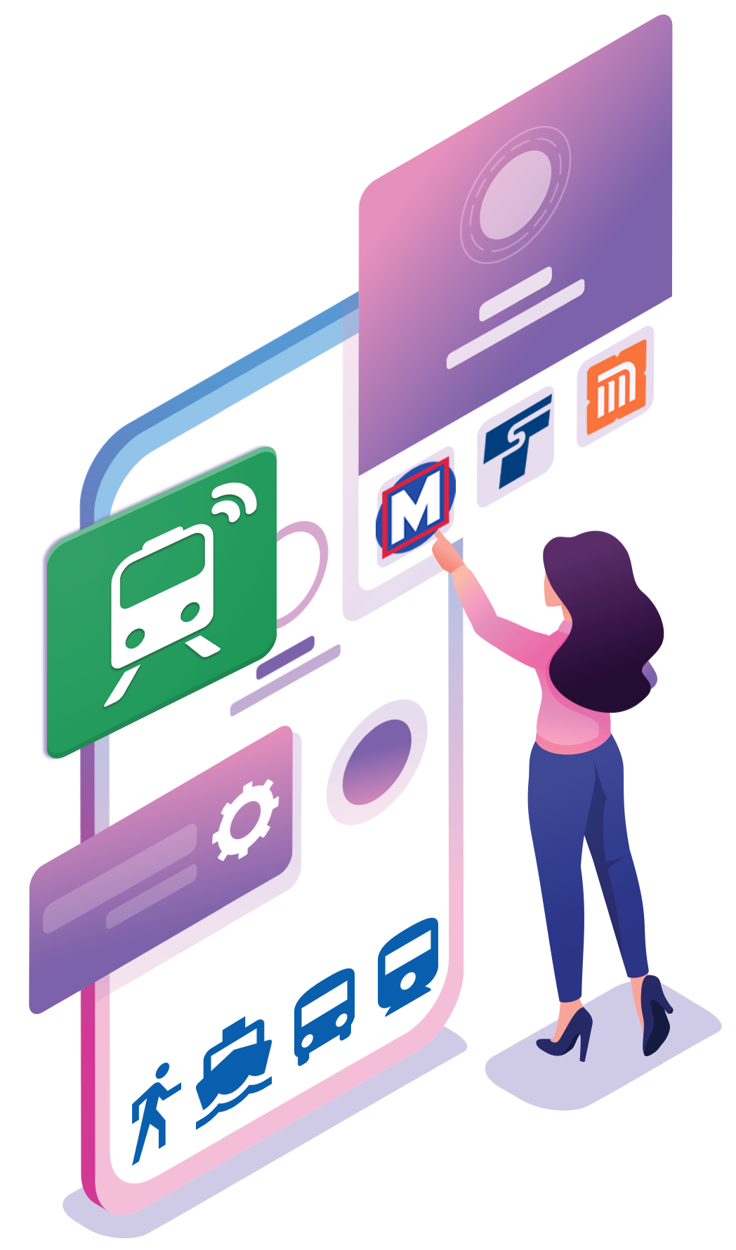
White Label & Co-Branded Mobility Solutions
Our apps are consistently rated highly for the accuracy of our data and the extensive range of features that can be customized based on your agency's needs:
- Service alerts and notifications
- Real-time arrival boards
- Offline schedules
- Trip planner, directions and address book
- Navigation, trip visualizer and way finder
- Favorite lines and stops

Transit Data API
Our focus and concentration on big cities allow us to offer a rich transit dataset with a much higher degree of accuracy than other transit data providers, which instead aim for worldwide coverage.
Every city is unique. It takes expertise, resources, and infrastructure to support a comprehensive dataset for a modern city. We consume and integrate a plethora of datasets from city agencies, transit operators, third-party partners, and social networks.
Our proprietary AI and Machine Learning algorithms then process, transform, and enrich this data to produce hyper-accurate transit details. We make our Transit Data API available to partners and academic institutions.

GPS Solutions & Fleet Management
Gain clear visibility into how your fleet is operating in real-time to improve profitability, safety, compliance and customer satisfaction, all while reducing operating costs.
- Manage resources effectively and gain visibility into fleet operations
- Stay informed with alerts and notifications for critical KPIs
- Visualize data and zoom into details
- Generate detailed reports
- Keep data private and secure
Our Services
White Label Apps
Leverage our technology platform to launch your own branded solution.
Co-Branded Apps
Reduce project costs and accelerate your launch with our co-branded app offering.
Transit Data API
Plug into our hyper-accurate transit APIs, which power our own apps, available exclusively for partners and academic institutions.
Fleet Management
Discover how your fleet operates in real-time. Enhance profitability, safety, compliance, and customer satisfaction, all while lowering fleet operating costs.
GPS Solutions
Looking to integrate GPS features into your existing software stack? Let's talk.
GTFS Solutions
Fulfill your organization's GTFS publication requirements with our comprehensive suite of data tools.
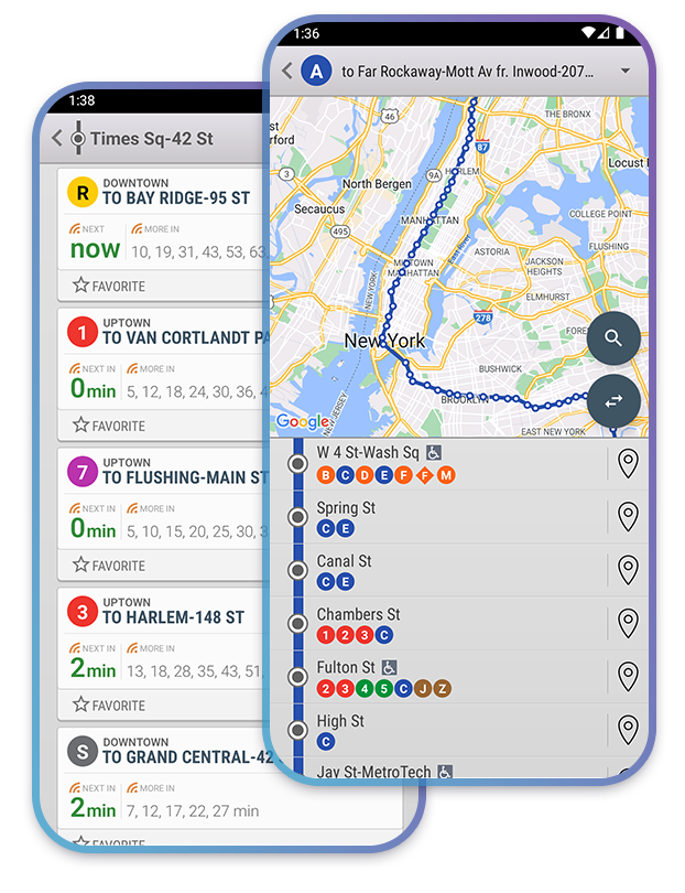
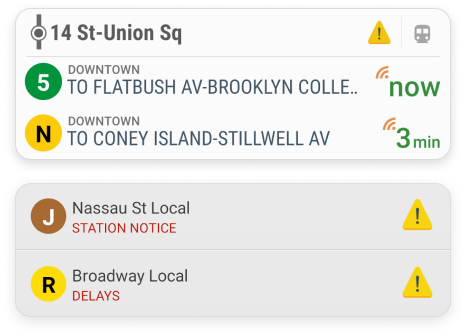
Real-Time Arrivals, Schedules, and Live Status
Experience the accuracy and reliability of our transit data. Access real-time arrival boards, schedules, and live transit statuses, all powered by our hyper-accurate AI prediction algorithms.
Transit Maps, Directions, Trip Planner
Discover the best routes and always know where you are with official transit maps, detailed directions and our intuitive, multi-modal Trip Planner.
Alerts & Notifications
Receive automatic service and safety alerts through customizable commute notifications.
Always know before you go!
Transport Modes
Subway, Metro
Bus
Rail, Trolley
Ferry
Micromobility
Walking
Rideshare
Microtransit, On-demand
26
Cities
96
Transit Operators
1853
Routes
12
Transport Types
Always Accurate
Get real-time information on the arrival times and statuses of public transit vehicles, including subways, buses, trains, ferries, and more!
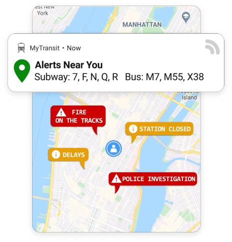
Alert Notifications
Stay in-the-know about transit changes and disruptions happening around you.
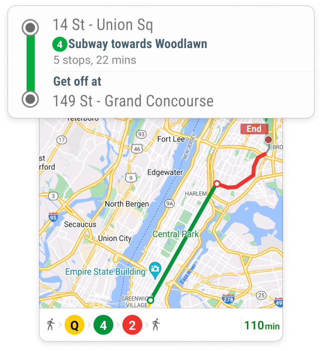
Trip Planner
Step-by-step guidance and timely information to navigate public transit with ease and confidence!
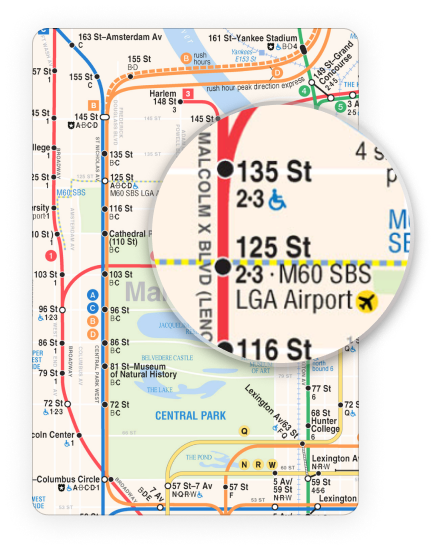
Maps & Directions
Comprehensive collection of officially licensed, high-resolution transit maps for all modes of transportation.